Free Standard Shipping for Orders Over €150. Learn More
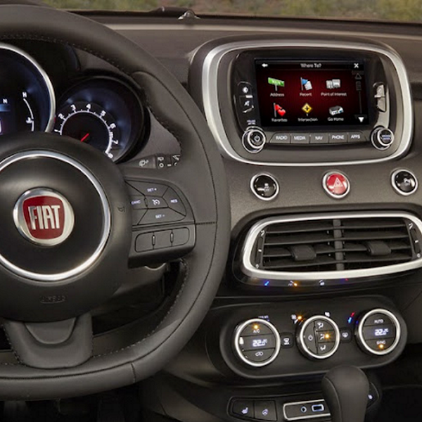
2021 Europe Map for Uconnect 6.5 Navigation".
Compatibility:.
Fiat 500L, 2013-2017
Fiat 500X, 2013-2017
Jeep Renegade 2013-2017
Alfa Giulietta 2014-2017
Cartography: All Europe + Radar.
Albania, Andorra, Austria, Belarus, Belgium, Bosnia and Herzegovina, Bulgaria, Balearic Islands, Channel Islands, Croatia, Czech Republic, Cyprus, Denmark, Estonia, Finland, France, Germany, Gibraltar, Greece, Hungary, Iceland, Ireland, Isle of Man, Italy, Kosovo, Latvia, Liechtenstein, Lithuania, Luxembourg, Macedonia, Malta/Gozo, Moldova, Monaco, Montenegro, Netherlands, Norway, Poland, Portugal, Romania, Russia, San Marino, Serbia, Slovakia, Slovenia, Spain, Sweden, Switzerland, Turkey, Ukraine, United Kingdom, Vatican..
It is necessary to attach the current version of the gps navigator to the command..
To see the version..
Click the settings button to the right of the touch screen.
System information.
A software version
After purchase, you will receive a link to download maps and instructions.
C It's easy to do, insert the USB key with the new maps loaded into your car's USB port, select the "Update" option and the system will show a screen asking for the activation code.
You need to take a picture of this screen, send it to us and we will send you the card unlock PIN.
Specific References
No customer reviews for the moment.
Uconnect 6,5" FIAT Europe 2021 Maps
The use of a GPS (acronym for Global Positioning System) makes it possible to determine the position, speed and direction of a receiving device using signals from satellites. It is primarily used for locating people, vehicles and objects, but can also be used for navigating maps, measuring distances and determining the most efficient route between two points. Here are some examples of uses of GPS: Vehicle Tracking: Many transportation companies use GPS to track the location and status of their vehicles in real time, allowing for better route and delivery efficiency of goods. People tracking: GPS can be used to track the movements of people, such as in the case of missing persons or in dangerous situations, such as mountain hikes or scuba dives. marines. Navigation: GPS is very useful for car navigation, providing accurate information about the route, distance and estimated time of arrival. Measuring distances: GPS can be used to measure distances accurately, such as in surveying projects or sports activities. Geocaching: GPS is also used in geocaching activities, where participants use the system to find hidden objects in specific locations.
 Security policy
All items are tested, filmed, packaged and come with a 24 month warranty.
 Delivery policy
Deliveries by courier and postal service throughout Europe within 1 to 3 working days.
 Return policy
Returns accepted in sealed shipping container and after RMA approved by us.
Custom accessories


