Free Standard Shipping for Orders Over €150. Learn More
Compatibility:
Valid for BMW / Mini Cooper systems with CIC PREMIUM (SA 609) navigation system.
- E60, E61 de 11/2008 a 05/2010
- E63, E64 de 11/2008 a 07/2010
- E70 de 10/2009 a 06/2013
- E71 de 05/2008 a 07/2014
- E81, E82, E87, E88 de 09/2008 a 03/2014
- E84 desde 10/2009
- E89 desde 04/2009
- E90, E91, E92, E93 de 09/2008 a 10/2013
- F04 de 11/2008 a 06/2012
- F06 de 03/2012 a 03/2013
- F07 del 10/2009 al 07/2012
- F01, F02, F03 de 11/2008 a 07/2012
- F10, F11 de 03/2010 a 09/2012
- F12, F13 de 12/2010 a 03/2013
- F20, F21 de 09/2011 a 03/2013
- F25 de 11/2010 a 04/2013
- F30 de 02/2012 a 11/2012
Cartography:
West Europe: Andorra, Austria, Belgium, Croatia, Czech Republic, Denmark, Finland, France, Germany, Great Britain (United Kingdom), Greece, Gibraltar, Hungary, Ireland, Italy, Liechtenstein, Luxembourg, Monaco, Netherlands, Norway, Poland, Portugal , San Marino, Slovakia, Slovenia, Spain, Sweden, Switzerland and the Vatican.
Only the main road: Albania, Belarus, Bosnia and Herzegovina, Bulgaria, Estonia, Latvia, Lithuania, Macedonia, Moldova, Montenegro, Romania, Russia, Serbia, Turkey and Ukraine.
Eastern Europe: Austria, Belgium, Bulgaria, Croatia, Czech Republic, Denmark, Germany, Hungary, Estonia, Finland, Greece, Italy, Liechtenstein, Latvia, Lithuania, Luxembourg, Netherlands, Norway, Poland, San Marino, Slovakia, Slovenia, Sweden, Switzerland and the Vatican.
Only the main road: Albania, Andorra, Bosnia and Herzegovina, France, Gibraltar, Great Britain, Ireland, Macedonia, Moldova, Monaco, Montenegro, Portugal and Spain.
Note that you need a valid FSC (unlock code) for each Navi update.
It is necessary to add the VIN number of the car in the order.
When ordering, choose shipping mode.
Specific References
No customer reviews for the moment.
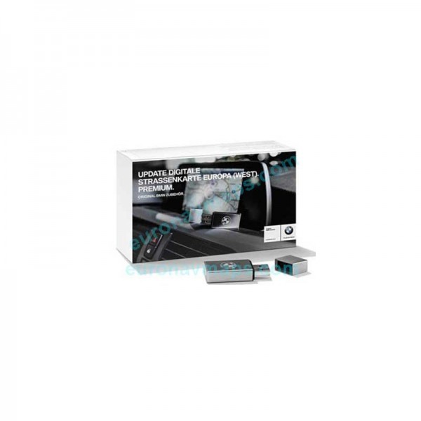
BMW Road Map Europe Premium CIC 2022
The use of a GPS (acronym for Global Positioning System) makes it possible to determine the position, speed and direction of a receiving device using signals from satellites. It is primarily used for locating people, vehicles and objects, but can also be used for navigating maps, measuring distances and determining the most efficient route between two points. Here are some examples of uses of GPS: Vehicle Tracking: Many transportation companies use GPS to track the location and status of their vehicles in real time, allowing for better route and delivery efficiency of goods. People tracking: GPS can be used to track the movements of people, such as in the case of missing persons or in dangerous situations, such as mountain hikes or scuba dives. marines. Navigation: GPS is very useful for car navigation, providing accurate information about the route, distance and estimated time of arrival. Measuring distances: GPS can be used to measure distances accurately, such as in surveying projects or sports activities. Geocaching: GPS is also used in geocaching activities, where participants use the system to find hidden objects in specific locations.
 Security policy
All items are tested, filmed, packaged and come with a 24 month warranty.
 Delivery policy
Deliveries by courier and postal service throughout Europe within 1 to 3 working days.
 Return policy
Returns accepted in sealed shipping container and after RMA approved by us.
Custom accessories


